2015 Fall Travels of the Mercury, Oct. 23rd to 26th.
Rains have been moving through Moab and we decide to head south for a few days to hike and bike in the Needles District of Canyonlands. We leave Moab early in the morning and take Hwy 191 south and then the Park Highway 211 to Needles. Squaw Flat Campground in Needles fills up early so we hope we can find a spot.
We're in luck and get the last open site. There are lots of really nice sites with great views scattered around the contours of a sandstone dome but they're all taken. Ours isn't one of the best being right next to the road but it has a nice Utah Juniper and a way to scramble up the rock. The rest of the afternoon less lucky people cruise around looking for a place. The cost is $14 or $7 with the Senior Pass. There are no hookups or dump station but there are flush toilet restrooms, camper sink for dishes, water available at hydrants and gorgeous scenery.
 |
| Our campsite at Squaw Flat Campground. |
Our first day is as rainy as Moab. Curtains of rain and cloud shadows team tag across the colorful landscape.
 |
| A cloudy, rainy day in Needles. |
When rain clears we take an afternoon walk. There are several trails that fan out from the Squaw Flat trailhead parking lot. These trails connect with others from the Elephant Hill trailhead making a network of loops of varying distances through the canyons and fins of Needles. It's a hikers paradise, better than Disneyland. The trails are rated easy, moderate and strenuous so there's something for everyone.
The trail network is so extensive that it can absorb multiple days of backpacking. Backpackers must get a permit and camp in designated camp sites for minimal impact on the land. Markers along the trails indicate the campsites. There are no bad back country campsites and water is available at several springs. During the rainy season abundant water can be found in potholes on the flat benches above the canyons.
 |
| Hundreds of potholes fill with water after the rain. |
 |
| Potholes mirror the sky. |
We start our afternoon walk at the Squaw Flat trailhead and hike a short couple-mile loop along Elephant Hill. The trail leaves the sandy wash and climbs over a humped back of slick rock.
 |
| A lone juniper nestled in this little basin.is a real survivor. |
We hike into a hollow where a lone Utah Juniper matches it's ability to survive with the indifference of the sandstone.
 |
| I'm just a small thing in this landscape. |
The view expands as we climb higher up the ridge and we can see the canyons and contours of the butte. It's easy to friction on the rock and venture into hidden landscapes.
 |
| Sensuous landscapes. |
 |
| Looking toward the Needles from Elephant Hill. |
 |
| Types of sandstone erode differently to create a sculpted rock garden. |
We reach the highest point in the trail with a grand panoramic view.
 |
| On the spine of a ridge the trail crosses over. |
What we see is a fast moving rain storm heading our way.
 |
| A rain storm sweeps across Needles. |
 |
| Let it rain, |
We scramble into our rain jackets just as the storm hits.
 |
| The rock is silvered with rain. |
 |
| Slick rock waterfalls happen minutes after the rain starts. |
The rock is silvered with rain and water is channeled into falls that thunder into the cracks below us. Follow where the water goes and you can see how it carves the stone.
 |
| We can see how the water carves the stone. |
 |
| The rain moves on and sunset illuminates the buttes. |
The rain moves on as we work our way down off the butte and back to camp. The land has turned from rock and desert to waterfalls and pools.
 |
| Sunset illuminates a distant butte. |
The next day the rains have passed and it's an excellent time for a long hike. The park has a nice trail guide in the park newspaper we picked up at the visitor center. We choose the 5 to 6 hour, 11-mile round-trip Peekaboo Spring Trail that will take us to pictographs in Salt Creek. The trail is rated as strenuous with some scrambling and exposure. Sounds interesting.
 |
| Yesterday's rain fills the pothole's mirrors. |
We start our hike on the Squaw Flat Trail that will connect with the Peekaboo Spring Trail. Potholes are filled with water from the previous days rain.
 |
| The trail parallels the Needles. |
For the first 1.5 miles the trail is fairly flat, crossing chaparral, a few low sandstone ridges and up Squaw Creek with views of the Needles Formations.
 |
| Jim on a ridge we cross to get from Squaw Creek to Lost Creek. |
In Squaw Creek the trail junctions with the Peekaboo Spring Trail and we leave the Squaw Flat Trail. After a scramble up to a ridge the trail becomes a cairned route on a broad, sloping bench that flairs out from the base of a sheer rock wall. At the outer edge the bench drops a hundred or more feet to the canyon floor. What's fun about this trail is that most of it is a carined route like this on benches between cliff and canyon, with wonderful panoramas.
 e e |
| Most of the Peekaboo Spring Trail is a cairned route on a sloping bench with sheer rock walls above and the canyons below. |
The trail descends from the ridge into Lost Canyon. There's one short 10 ft. ladder to help with the descent. We hike down Lost Canyon for about a quarter mile until the trail forks and we scramble up to another bench. The best segment of the trail is from Lost Creek to Salt Creek. It undulates along the bench around a cliff for several miles before dropping into Salt Creek.
We see a rock formation that looks like a figure wrapped in a blanket and we call it Shaman Rock. It becomes one of our landmarks.
 |
| Shaman Rock. |
 |
| The sun illuminates Shaman Rock. |
 |
| Shaman Rock in a panorama. |
 |
| The trail passes through a window in a rock fin. Shaman Rock is in the background. |
 |
| The trail contours along the cliff on a high bench and offers views into numerous canyons. |
 |
| There's a 14 ft. ladder to descend to the floor of Salt Creek. |
We descend domes of rock as we approach Salt Creek. The final descent to the floor of the canyon is down a crack on a 14 ft. ladder with rock steps at the bottom.
 |
| At the bottom of the ladder. |
From the bottom of the ladder it's about a quarter mile hike up the canyon along the cliff wall to the pictographs site.
 |
| Peekaboo Spring pictograph panel. |
The Peekaboo Spring pictograph panel is on each side of a window in the rock wall. Here are some of the images.
 |
| Two shield figures overlay fainter larger-than-life red anthropomorphic figures. |
 |
| Jim and I at the Peekaboo Springs pictographs. |
 |
| Two snake pictographs. The bottom snake is very faint. |
 |
| White dotes overlay a faded red anthropomorphic figure. |
 |
| White hand prints with designs. |
White hand prints with designs looks like they've been made by painting a design on the palm and pressing the hand to the wall.
 |
| Red hand prints. |
 |
| A reverse hand print made with spattered paint. |
The hand prints are the most personal of the pictographs. Perhaps they are made as part of a ceremony or maybe to make a connection with the spirit of the spring, to ask a blessing or offer a prayer. The individuals hand print is a way of saying, "This is I."
 |
| Comparing hands. |
The hand print is the unique mark of an individual. More personal than a signature in writing. I compare my hand with theirs. We reach for each other across the centuries.
 |
| Information panel at the pictograph site. |
It's past mid-day at the pictographs and time to head back to the campground. The hike is incredible as we retrace our way across the benches and along the canyon rims.
 |
| We follow cairns as we descend into Lost Canyon. |
We take a break at the top of the last ridge above the short ladder on our hike back and see an interesting shape in the distance. The marks on the canyon walls don't match up and we realize that we're looking at Druid Arch miles away.
 |
| Druid Arch in the center of the photo. |
The hike took us 6 hours but we spent time sitting and enjoying the views. Part of the hiking is the stopping to enjoy the being there.
 |
| Biking in Needles. |
On our last day we take a 15-mile bike ride on the paved roads in Needles. 15 miles is all the pavement there is. The ride is easy with some short descents into shallow canyons and enchanting views of hoodoos and massive rock walls. Here are some scenes from our ride.
 |
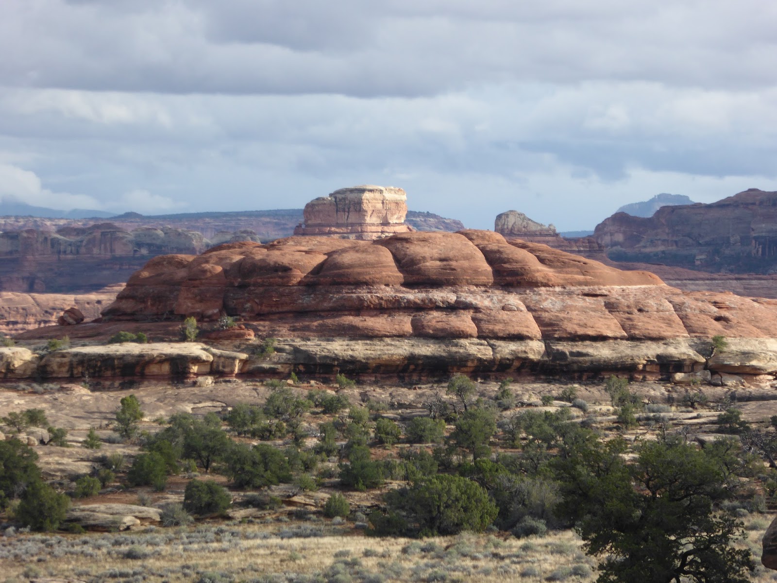
| Rock formations at the Confluence Overlook trail head. |
 |
| Rock formations at the Colorado Confluence trail head. |
We ride back to the Visitor Center and then to the Colorado Confluence trail head.
 |
| Every rock is a sculpture. |
 |
| Sunset shadows slide across sandstone walls. |
At the end of the day the sunset performs in shifting shadows bright colors. The Squaw Flats Campground has the most beautiful views of any campground where we've ever stayed.
We will leave Needles and return to Moab for more canyoning with friends. Next time we'll canyoneer Under Cover Canyon.
Until then.
Jackie


 e
e


Every time I see a new entry in your blog I open up my map before even clicking on it because I know I'll probably be adding a pin or two to my map before I'm done reading it.
ReplyDeleteJust keep on truckin", maybe someday our paths will again cross
ReplyDeleteJIM