 |
| Our boon dock site on BLM land west of Hanksville, UT. |
 |
| Intriguing badland vistas near Hanksville, UT. |
Our next destination is Capitol Reef. We continue on Hwy 95 to Hanksville and take Hwy 24 to Capitol Reef. This is a scenic drive through sandstone canyons and crumpled, eroded badlands. For the next few nights we’ll boon dock in the solitude of BLM and National Forest lands. The nights are so dark that the Milky Way stretches across the sky from horizon to horizon. Before dawn Venus, Jupiter, Mars and Uranus hang in the sky above the crescent moon. Places like these are what our Sprinter was made for.
 |
| Driving to Capitol Reef on Hwy 24. |
 |
| At the trail head to Grand Wash in Capitol Reef. |
 |
| Jackie in Grand Wash narrows in Capitol Reef. |
 |
| Grand Wash narrows. |
 |
| Jim hiking up Grand Wash. |
 |
| Grand Wash narrows. |
 |
| Grand Wash narrows. |
 |
| The canyon begins to widen. |
 |
| The canyon opens up and it's a good turnaround point to hike back through the narrows to the trailhead. |
 |
| The continuously changing landscapes of Capitol Reef. |
 |
| A panorama looking east across Capitol Reef from Boulder Mt. |
 |
| The trial up Calf Creek to Lower Calf Creek Falls |
 |
| Calf Creek at the beginning of the hike. |
 |
| Colorful formations along the trail. |
 |
| Banded formations tower above the trail. |
 |
| Three larger-than-life Fremont pictographs decorate the canyon wall in Calf Creek. |
 |
| High canyon walls converge at we near the falls. |
 |
| 128 ft. Lower Calf Creek Falls and pool. |
 |
| Looking up at the falls. |
 |
| The pounding water sculpts the rocks. |
 |
| Refreshing spray cools the air even on the hottest day. |
 |
| Lower Calf Creek Falls in black & white. |
After our hike we travel on to spend the night at the Bryce Valley KOA. This is a nice campground surrounded by colorful sandstone cliffs. A great place to camp when you need a full-service campground and want to spend time visiting Bryce Canyon and Kodachrome Basin.
 |
| Hwy 12 curves around the upper reaches of the Escalante-Grand Staircase National Park. |
The next day we continue on Hwy 12 to the trail head for the Red Canyon Bike Path near Bryce Canyon. We won’t visit Bryce because we’ve been there but we’ll stop and take a ride on this wonderful bike path. It’s a 12.5-mile paved path from Red Canyon to Bryce Canyon giving us a 25-mile round trip ride. We do a lot of road riding but we always enjoy riding on a quality bike path and always take the time to ride when we find one. This one is exceptional with good paving and wonderful scenery.
After our ride we head north on US 89 through Panguitch and
turn east on Highway 62 at Junction. We’re wandering our way across Utah on
scenic little mountain highways. Small farming communities nest in the valleys
amid fields and pastures. It’s so much better than traveling the interstate and
we’re seeing some beautiful country.
 |
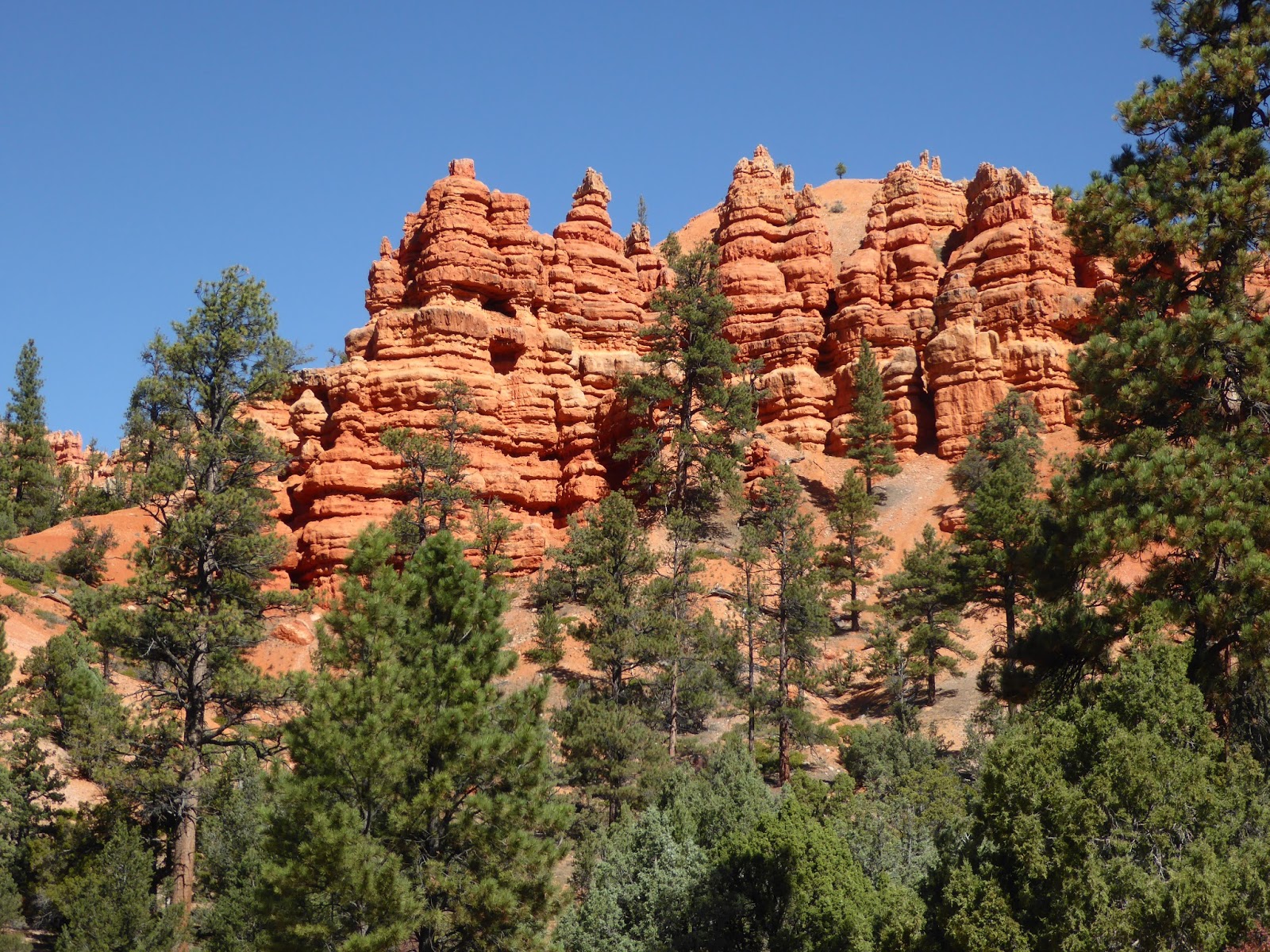
| Red Canyon on Hwy 12 east of Bryce Canyon. |
 |
| The Red Mountain Bike Path is nicely pave and scenic. |
 |
| Jim climbs the bike path. The return tip will be a breeze. |
 |
| Bike path and highway share the scenery. |
 |
| Picturesque formations along the bike path. |
At Koosharem we turn onto Hwy 24 then take Hwy 25, the
Fishlake Scenic Byway. Our destination for the night is a BLM campground at
Fish Lake. The campground is primitive but there are flush toilets and water at
faucets. The sites are among the aspens and overlook the lake.
The next day we have to backtrack to Hwy 24 due to road
work. Hwy 24 will take us to Loa where we head north on Hwy 72 to I-70. A short
drive east on I-70 takes us to US 191 heading for Moab.
In our next post we’ll tell you about our canyoneering
adventures and a great hike in the Needles District of Canyonlands.
Until then,
Jackie
Jackie
 |
| Jim & Jackie at Lower Calf Creek Falls. |
Very nice, the Blog is a great idea, wish I thought of it several trips back. Thanks for the information, I will take advantage of your experience here. I especially appreciate the comments on the shorter scenic hikes. My wife can't hold up under long hikes so when she is with me I attempt to keep them short and easy. I like the longer more difficult ones but I just do that when it's me and my buddy.
ReplyDeleteThanks again
George