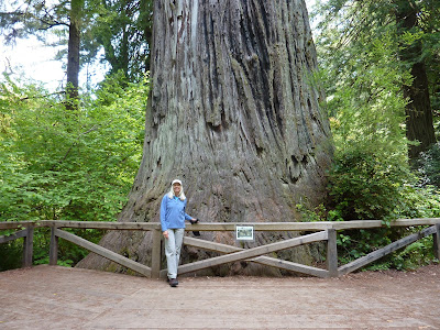
After our stay at Burlington Campground in Humboldt Redwoods State Park we're back on Highway 101 and heading north. Our next camp is at Patrick's Point State Park north of Eureka. This park is in dense rain forest on coastal cliffs. The campground has flush toilets, token operated showers, dump station and water available at numerous location in the campground. The cost is $35 per night, $33 for seniors.
 |
| At the Entry Station parking lot the Rhododendron dwarfs our Sprinter. |
 |
| Huge bouquets of Rhododendron blooms. |
 |
| These lovely Western Azaleas were next to our camp site. |
 |
| Our camp site in the rain forest at Patrick's Point |
There are numerous recreational opportunities and programs at the state park. The Sumeg Village, a Yurok Native American interpretative center was built in the state park in the 1990s by the Yurok people for cultural and educational activities. There is also good wildlife viewing along the many hiking trails that meander through the forest, traverse the ocean cliffs and lead down to the Agate Beach.
We hiked the Ceremonial Rock Trail that connects the campground to the coastal trails and climbed the fern-lined stone steps to the top of Ceremonial Rock.
 |
| The Ceremonial Rock Trail leading to the top of the Rock. |
 |
| The stairs lead ever upward. |
I forgot to get a photo of the Rock and the view from the top.
We continued following the trail through this lovely primeval rain forest to the view point along the cliffs.
 |
| Along the Ceremonial Trail. |
 |
| Wedding Rock at Patrick's Point, a beautiful spot to begin a marriage. A trail leads to the top. |
 |
| Lupines and Sweet Peas. |
We leave Patrick's Point and stop at the Newton B. Drury Parkway to take a 19-mile midday bike ride through a Redwood grove. The parkway parallels Highway 101 for about nine miles and is a pleasant alternate route. It's a nice, easy ride with a few climbs and good pavement.
 |
| Newton B. Drury Parkway makes a nice bike ride. |
 |
| Jackie riding on the Newton B. Drury Parkway. |
 |
| Big Tree. |
There are several hiking trails along the Parkway. One leads to the Big Tree, a giant redwood.
 |
| Jackie at the Big Tree. |
 |
| Big Tree. |
 |
| The path to the Big Tree wanders through an emerald forest. |
At Crescent City we leave 101 and take Highway 199. We intended to stay at Jedediah Smith Redwoods State Park but it was full so we drove on to our second choice, Panther Flat, a National Forest campground in the Smith River National Recreation Area. As luck would have it this is a very nice campground and only cost us $7.50 per night with our senior pass ($15 regular rate).
The campground has paved roads and sites that are widely spaced in forest next to the Middle Fork Smith River. There are flush toilets, token operated showers and water taps in various locations but no dump station. There is a day use parking lot for fishermen and trails to the river from the camp sites.
 |
| Our camp at Panther Flat. |
 |
| The Middle Fork Smith River looks like good fishing. |
 |
| Firecracker flowers. |
Panther Flat is the northern point in our travels. We head back to Crescent City and travel south on Highway 101 toward Eureka. At Eureka we take 299 toward Redding. We are going to visit the great National Parks in the majestic Sierra Nevada Range. Highway 299 is a great scenic route to take from the coast to the interior.
We've found the state and national parks are full on the weekends so we'll spend Friday and Saturday night at small agency campgrounds before arriving at Lassen Volcanic National Park on Sunday.
On Friday night we camp at Hayden Flat Campground by the Trinity River on 299. It's a small Forest Service campground in the Shasta-Trinity National Forest. There are vault toilets and water but no dump station. The cost is $12 per night or $6 with Senior Pass. The sites are small, there are no hiking trails and 299 is too busy to bicycle especially with no highway shoulders and a lot of big truck traffic. It's a noisy campground since it's on the start of a climb up the mountain. There's nothing for us to do here so we move on to the next campground.
 |
| Hayden Flat Forest Service Campground on the Trinity River. |
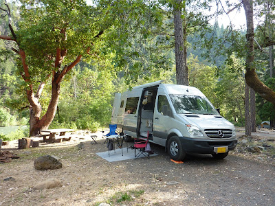
The next campground 20 miles down the road is Junction City, a BLM campground a couple miles from the little community of Junction City. It's a nice campground with large, widely space paved sites and interior roads. There are vault toilets and water but no dump. Although it's near 299 it's fairly quiet because the road is flat. Fisherman can walk across the road and find easy access to the Trinity River.
We set up camp and take a 28 mile bike ride on state road 401 up Canyon Creek Road from Junction City. It turned out to be a good bicycling road with over 1,000 ft of climbing and some steep grades in 12 miles. Sections of this narrow 2-lane road become single lane in places. It was a good workout and a great descent.
 |
| Junction City BLM Campground. We heard Long-eared Owls after dark. |
Now that the weekend's over it's time to go to Lassen Volcanic National Park. We stop in Redding to resupply and then take Highway 44 to Lassen. The west entrance and ranger station are near the junction of on Highway 44 and 89. The Loomis Museum is located here and offers geological information and history of the area. Lassen Volcano last erupted 100 years ago this May and they had just finished with centennial activities. The park has all three types of volcanoes; plug, cone and shield. There are numerous lakes and trails throughout the park for excellent backpacking and hiking opportunities.
Manzanita Lake Campground is at this entrance and we decide to camp here for four nights. The campground has four paved loops with paved sites. There is one loop only for tents, one loop with cabins and two loops for RV's and tents. Most sites are small and out of level so we drove around before deciding on a site. There are flush toilets, token operated showers and a dump and water station along the road into the campground. Water faucets are located through out the campground. A small grocery store also has a snack bar, kayak rentals and laundry. The cost was $18 per night or $9 with the Senior Pass. The rate was going to go up to $20 on June 1st. This is a very nice campground.
 |
| Manzanita Campground. |
 |
| The campground is among very tall Jeffery Pines. |
On our first morning we take a hike from the campground on the 3-mile trail around Manzanita Lake. There are fisherman in canoes and kayaks on the lake on this beautiful morning. Lassan Peak sleeps under it's blanket of snow on the southern horizon.
 |
| Lassen Peak Volcano looks down upon Manzanita Land and campground. |
In the afternoon we take a 27-mile bike ride on the Lassen Volcanic National Parkway from Manzanita Campground to Summit Lake and climbed 1,200 ft. The Parkway is excellent for road bicycling. The pavement is new and smooth and traffic is light with a low speed limit of 45 mph. It's the 1st of June and still nippy at the 6,000 to 7,000 ft. elevation.
 |
| The east face of Lassen Peak. |
 |
| The ride from Manzanita Campground to Summit Lake was great even if a little nippy. |
 |
| Snow Plants set like bright Christmas candles on the forest floor. |
The Snow Plants are blooming and look like bright Christmas candles placed randomly on the forest floor. They get their name because they emerge as the snow recedes. They can get from 8 to 24 inches tall. Once you've seen them you'll never forget them.
 |
| Snow Plants. |
On our 2nd day we hiked up Manzanita Creek on the Chaos Crags Trail. It's one of several trails that begin at the campground. The trail went to Crags Lake which looked like it hadn't had water for several years. It was a very nice 5-mile round-trip hike through the Jeffery Pines and a section of old burn that gave us nice birding opportunities for Brown Creepers, Wrens, Nuthatches and a variety of Woodpeckers.
 |
| The trail to the Crags. |
 |
| Crags Lake was dry but the hike beautiful. |
On our 3rd day we decide to drive to the parking lot at Hat Creek and ride our bikes to the Lassen Peak Trailhead at the highest point, 8,212 ft. on the Parkway. We were pleased to see the quality of the road was good all the way. It was only a 21-mile round-trip ride but had a consistent fairly steep grade all the way. Clouds, 1,500 ft elevation gain, and snow along the road made the ride cold but we kept a good pace. The fast descent had us almost frozen on our bikes. Oh, but we had fun! We highly recommend this ride.
 |
| The Parkway climbs toward Lassen Peak. |
 |
| The view from the climb looking SE with the road below. |
 |
| The remnants of snowbanks line the road. |
 |
| Reading Peak and the Parkway curving away below. |
The highest point in the road is at the Lassen Peak Trailhead and there's plenty of snow. The clouds are gathering and we make a quick descent.
 |
| We arrive at the highest point on the parkway. |
When we get back to the Sprinter at the Hat Creek parking lot we take a short 1.3 mile hike to Paradise Meadow, one of the many lovely trails along the Parkway.
 |
| Hat Creek. |
We depart Manazita Lake and head south to Lassen's southern entrance.
 |
| Lake Helen below Lassen Peak still has winter's ice. |
Lassen has many volcanic features like those in Yellowstone. Bumpass Hell is one of those features. We didn't take the time to hike the 1.3 mile trail to it and wish that we had. It's something that is worth a return visit to see. There were femerals and mud pots at the trail head.
 |
| A hillside of steaming femerals at Bumpass Pass. |
 |
| Sputtering mud pots along the Parkway at Bumpass Pass. |
Our next destination is Antelope Lake which Jim discovered on the Benchmark map. He looked it up on the Paddle California web site and it was highly recommended. It has many inlets and coves that invite exploration by canoe or kayak. To get there we take Highway 44 from Lassen to Susanville then 395 south and turn onto forest road 01 to Antelope Lake.
 |
| The beautiful blue waters of Antelope Lake. Lots of fishing opportunities. |
We'll be spending 3 nights here to take advantage of the great kayaking. We camp at Lone Rock Forest Service Campground. There are vault toilets, water available but no dump station. There's a dump station at Long Point Campground. Boats can be launched at the ramp at Lost Cove and pulled up to the shore at Lone Rock. Lone Rock also has a place to park boat trailers.
The sites and interior roads are paved. The pavement is crumbling at the edges but serviceable. The cost is $25 per night or $12.50 with Senior Pass. Lone Rock is heavily shaded by Jeffery Pines. On Thursday night it was filling up for the weekend. We want some sun for our solar since we won't be traveling for the next three days so we find a nice site on the edge of the campground with plenty of sun and access to the lake where we can put in our kayak.
 |
| Our site at Antelope Lake. |
We set up our kayak in the afternoon and take a short paddle around the cove near our site.
 |
| Our campsite by the lake taken from our kayak. |
 |
| There are beaver dams at the head of the inlet to our cove. |
We took 2 kayak trips around the lake during our stay. Winds were often calm and the lake glassy. There are 15 miles of shoreline with many coves and inlets with beaver dams and marshes to explore and are excellent wildlife viewing. We saw Osprey, Bald Eagles, White Pelicans, Canadian Geese with goslings, Redhead Duck and Wood Duck. As we paddle along the shore we also saw many forest birds and Mule Deer. We highly recommend this lake for kayaking, fishing and a wonderful place to camp. We scared up a Common Merganser with 8 chicks hitching a ride on her back. Too sudden to get a photo.
Here are photos from our kayak trips.
 |
| Paddling toward a cove. |
 |
| Exploring an inlet. |
 |
| Paddling out of the inlet and into the lake. |
 |
| Mule Deer brows along the lake undisturbed by our quiet passing. |
 |
| White Pelicans spend the summer on the lake. |
 |
| White Pelicans on the blue waters of Antelope Lake. A pretty site. |
 |
| A little break for lunch on the shore. |
 |
| Heading across the lake and back to camp. |
Near our camp we find a Red-breasted Sapsucker nest hole. The pair are busy coming and going feeding their young. We can hear the babies peeping in the nest. Jim sets up his scope/camera and gets some great shots. Sapsuckers are named for the shallow holes they drill in trees were the sap and insects they feed on collect. Very handsome birds.
 |
| Red-breasted Sapsucker. |
 |
| Red-breasted Sapsucker brings food for the young. |
 |
| The Sapsucker has a beak filled with sticky treats for the youngsters. |
The sun sets softly on our last evening. We've enjoyed our stay and will stay here again if we get back this way.
 |
| The sun sets quietly on the peaceful cove next to our site. |
We leave Antelope Lake for Lake Tahoe. See you down the road.
Jackie


No comments:
Post a Comment