Sunday, March 26, 2017

2016 Travels, Hiking to petroglyphs near Moab, UT

Every year like the birds going south we find ourselves in Moab for the beautiful October to go biking, hiking and canyoneering with friends. The place has gone crazy. RV parks are full and we find ourselves camped at William's Bottom, a primitive BLM campground on the Potash Road along the Colorado River south of town. The only amenities are a dumpster and an open-air pit toilet. The campground backs up to a beautiful red sandstone wall. The cost is $15 per night, $7.50 with Senior Pass.
Our camp at William's Bottom.
The campground is right along the road with lots of tourist and mine truck traffic which can get pretty noisy but it does quiet down at night.

William's Bottom CG is sandwiched between red sandstone walls and Potash Road.
There are nice views of Behind the Rocks on the other side of the river from the campground.

A river side view of Behind the Rocks.
From the campground there's an easy 19-mile ride along the Colorado River to the Potash mine.

Jim enjoys a nice 19-mile bike ride from the campground to the Potash mine.

Can't beat the scenery and lack of traffic on thia beautiful afternoon.

The Colorado River is pretty lazy along this stretch.
On our 2nd day we did a 40-mile ride on the Moab bike path to the top of Sky Island in Canyonlands. We didn't bother to take any photos because we've ridden this so many times. If you'd like to see photos look back to our Moab posts from the last two years. These bike paths are some of our favorites. The scenery is outstanding.

Kim, Lisa and Jim. We're ready for a hike into the canyons.
We met up with our friends, Kim and Lisa, for a hike to look for pictographs in the canyons around Moab. There will be plenty to see.

Pictographs of people and animals with damage done to the panel by recent visitors. 
Most of the pictographs are Freemont. Early homesteaders and even more recent people have left their marks as well as damaging some of the rock art. For this reason we never tell anyone the locations though some may be able to guess.

Intrepid hikers, Jackie, Lisa and Jim.

Jackie, Lisa and Kim.
The Utah canyons never cease to astound with their serenity, solitude and contrasts.

Just another canyon in Utah.

We find an interesting and very sensual cave.

Lisa leads us further down the canyon.

We find a feathered serpent, clan sign, deer, and a more recently scratched in figure.

Nice sandstone pavement makes for good hiking on the canyon floor.

A cattle trail leads up canyon.
Pictographs of shaman, animals and circles.

A shaman and circles.

Linked circles.
Here are some odd and very old pictographs we can't figure out. I thought the linked circles looked like chains of frog eggs.

A nice panel of people, Big Horn and Elk.

Kim and Jim in the canyon.

Figures join hands in a dance or ceremony.
One of my favorite panels were of figures holding hands in a dance or ceremony. There are also clan signs.
Figures with head dresses join hands in a dance.

A panel high on a cliff shows animals and people.
A panel high on a cliff wall depicts animals and people with hands joined. It looks like a migration. The petroglyph at the top is called a rack. It may depict rain.

Shaman and animals.
Part way down the canyon the bedrock brings the water to the surface and we stop for lunch on the rocks by pleasant pools and ornamental waterfalls.

Kim, Jackie and Lisa.

Ornamental waterfalls sing a story of water in the desert.
A few more miles and we're back to the car. Our hike and a pleasant day in good company comes to an end.

Moab Man says goodbye for now.
Join us in our next post for some canyoneering in Arches.
Until then,
Jackie


Monday, March 13, 2017

2016 Travels, Bicycling the River Front Trail, Grand Juntion, CO.


Grand Junction, CO is a favorite stop on our travels because it's often on our way to where ever we're going. We'll stay at the Saddlehorn Campground in the Colorado National Monument.

The west entry to the Colorado National Monument.
The high mesa of the Colorado National Monument boarders Grand Junction on the southwest with the Colorado River flowing at its base. The road to the top and along the rim of the mesa is breathtaking.
Approaching the tunnel on the west entry road to monument.
The west entry road to the top goes through a tunnel. The tunnel is short but bicyclists have to have lights to ride this road. The east entry has two shorter tunnels and lights are also required. Each has a rather steep grade in places on these 1,500 ft. climbs. We've bicycled the Monument from both the east and west entries in the past couple years and if you're interested you can go to our previous blogs.

Our camp at Saddlehorn Campground in the Colorado National Monument.
The Saddlehorn Campground, on the west end of the Monument, is about half a mile from the Visitor Center. The sites are no-hookup, water is available at tapes and there are modern flush toilets. The cost is $20 per night, $10 with the Senior Pass. The view is outstanding! We chose a site with an unobstructed view of the Book Cliffs north of Grand Junction.

The Book Cliffs at sunset from our site at Saddlehorn Campground.

Colorado National Monument viewpoint on the trail from the campground to the Visitor Center.
From the campground it's an easy half-mile walk to the Visitor Center along the rim. The trail offers views into the canyons and across the mesa.

Jackie stops along the trail to the Visitor Center to catch the view.
The Visitor Center has exhibits and gift shop. We're collecting patches from all the National Monuments and Parks we visit so going to the gift shop is a must. It's also fun to talk to the rangers and get their personal recommendations on trails and other things to do. We're always impressed with the architecture of the Visitor Centers of our Parks and Monuments. The designs are inspired by the landscapes.
Colorado National Monument Visitor Center entrance.

A commemorative sculpture of John Otto.
A sculpture at the Visitor Center entrance honors John Otto who built trails, promoted and became the first custodian of the Monument.

John Otto commemorative plaque.
This year we're going to ride the Riverfront Trail along the river. Notably a very flat ride compared to the Monument.

Along the trail we met a bicyclist wearing a volunteer vest and had the chance to ride with her. She told us that a group of cyclist who rode the trail often became trail volunteers and donned their vest whenever they ride the trail. They give information, directions and helped people with any problems. What a great concept.

Jackie rides the Riverfront Trail along the Colorado River.
The Riverfront Trail is a paved trail from Fruita to Palisade along the Colorado River. It's been 25+ years in the making and the last segments have recently been completed. There are several tailheads and parking areas that provide access and toilet facilities. We started our ride from the trailhead at 7th Street in Grand Junction and rode east to Palisade and back. With plenty of day left we kept on riding to Fruita, almost to the west end of the trail, and back. I don't remember how long the trail is from one end to the other, but we had a nice, easy ride of 37 miles.

The James M. Robb - Colorado River State Park
The Gunnison River flows into the Colorado south of Grand Junction. The convergence of these two great rivers create a wetlands habitat and fishery that's rich in wildlife. The area is preserved as the Colorado River State Park. We saw a Great Blue Heron rookery in the marsh.

Riding through the wetlands at the confluence of the Gunnison and Colorado Rivers.
The trail has great views of the Colorado National Monument on the horizon.

Jackie on the trail with the Colorado National Monument on the horizon.

Canada Geese sculpture along the trail.

Looking up at the Colorado National Monument. Our camp is up there somewhere.

The trail passes through riverside wildlife habitat.

Racing back to the trailhead after some pleasant hours on the bike.
We race back to the trailhead after several pleasant hours on our bikes and head back up the road to Saddlehorn campground on top of the Monument. Tomorrow we'll be on our way to Moab to spend the beautiful month of October hiking, biking and canyoneering.

Join us for our next post from Moab, UT.
'til then.
Jackie


Tuesday, March 7, 2017

2016 Travels, Vedauwoo Campground in Wyoming and Bicycling the Rio Grande Trail in Colorado.

It's September 24 and we're in Wyoming heading into the Rockies. We camp for a night at Vedauwoo Campground in the Medicine Bow National Forest between Cheyenne and Laramie along I-80. Vedauwoo is just the perfect campground for our Sprinter. The sites are no-hookup with vault toilets and water available at taps. The cost is $10 a night, $5 with the Senior Pass. The campground has several paved loops of sites set in between ridges of beautiful fractured boulders. There is even a loop for tents only. This gorgeous campground offers rock climbing, miles of hiking trail explorations and solitude. If you're traveling through southern Wyoming this is the place to stay.

Our campsite at Vedauwoo.
One trail is paved for handicapped accessibility. We rounded a bend and came upon a moose and her calf. They were quite the surprise. We had no idea there were moose in Wyoming. We watched them for a while than went back the way we came not wanting to disturb them and their peaceful munching on aspen leaves. Besides, they were right at the edge of the trail and you don't want to upset mother moose.

A paved handicapped accessible trail.

Mother moose and calf munching aspens along the trail.
We spent the afternoon following other trails that wend through these scenic boulder canyons and enjoying the fall colors. These trails would be beautiful in all seasons.

Fall color at Vedauwoo.
Weather is starting to move in and our hike is brisk and solitary. Great boulder walls rise up around us and the air is filled with the sweet scent of fall.

Distant vistas along the trail.

The bones of the earth poking into the sky and painted with lichen.

The hiking trail into the boulders.

A mushroom rock.

A trail leads into a chasm between boulder ridges.
While we're having dinner we watch a group of climbers ascend the rocks in the face of winds and fast moving clouds.

We watch rock climbers from our campsite.
The weather changed over night and we woke to snow in the morning. It's time to head south. We're going to take scenic, very winding backroads along the west flank of the Rockies to Glenwood Springs. From Laramie we go south on Highway 230 which becomes Highway 127 at the Colorado state line. At Three Way, CO we take 125 south to Walden and than continue southwest on Highway 14. When 14 junctions with US 40 we turn southeast onto 40 and go to Wolford Mountain Reservoir. From the reservoir we turn west onto Highway 134 and take a very scenic drive over Gore Pass. When 134 junctions with Highway 131 we turn southeast and end up at Wolcott on I-70. Got all that? In western Colorado there are no direct routes but they are always gorgeous drives. 

The height of fall color in Colorado.
We're in time for the height of the fall color. Here are some photos from our drive along the Rockies.
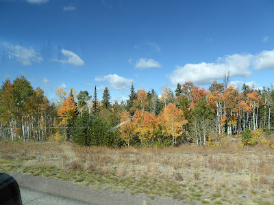
Photos from the window.

Aspens come in all colors from reds to yellows.
The storm that recently moved through added more snow to the Rockies.

First snows on the Rockies.

Aspens at Gore Pass.
We follow Highway 134, climbing through a corridor of golden aspens, to Gore Pass at 9572 ft.

Aspens at Gore Pass, 9572 feet.

We follow Highway 131 south to Wolcott, a little blip along I-70, than take I-70 west to Glenwood Springs and the end of the road for our long day of scenic driving. We came here to ride our bikes on the Rio Grande Trail, a paved Rails to Trails that runs from Glenwood Springs to Aspen. We couldn't find any camping in Glenwood Springs so we went up Highway 82 to Carbondale and decided to start our ride from there.
The Rio Grande Trail.
The Rio Grand Trail isn't named for the river but for the railroad. It climbs at a steady railroad grade from Glenwood Springs to Aspen, a total of about 44 miles one way. From the Carbondale trailhead where we start our ride, it's 29 miles, a round trip to Aspen of 58 miles.

A perfectly sunny day for biking on the Rio Grande Trail.
The early fall weather is perfectly wonderful and all we need are long sleeved jerseys.

Goats at work.
Along the way we encounter goats at work. Mesh construction fences and "Goats at Work" signs are put up along the road and trail shoulders and the goats are turned loose to devour the summer weeds. Better than mowing and everyone does their part. Aren't they adorable. Occasionally there's a little hanky panky.

Munching the weeds.

Fall color and mountain scenery along the Rio Grande Trail.

A few of the old Rio Grande Railroad cars are placed along the trail.

The mountains are snowcapped near Aspen.
In Aspen we get lunch a at pizza and sandwich pub and people watch from the deck. You can imagine all the fancy cars going by. It's not what we see in our little town.

A buffalo sculpture made with car bumpers along the river in Aspen.
The sandwiches we had for lunch were big and wonderful and delicious and it's a good thing it's down hill all the way back to our Sprinter.

The trail follows the Roaring Fork River from Aspen to Glenwood Springs.
We race back downhill along the Roaring Fork River.

Signs point the way when the trail does some zigs and zags.

A group of young gals take and afternoon ride.

Jim on the bridge across the Roaring Fork River.

Looking down into the Roaring Fork River from the bridge.

Shadows start to creep across the trail and river before we get back to the trailhead.
We highly recommend the Rio Grande Trail. The tail surface is excellent, the grade is steady and the scenery is wonderful. Maybe next time we'll ride the trail up from Glenwood Springs.

The Carbondale-Crystal River KOA.
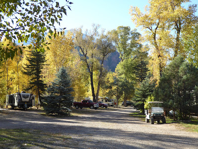
We also recommend staying at the Carbondale-Crystal River KOA. It's along the Crystal River, very peaceful and not too far out of the way. Sites are shady and they have great shower facilities. We took a no-hookup site for $21 a night. They have full-hookups, dump station and water.

Looking up at the mountains from our site at the Carbondale-Crystal River KOA.

The Carbondale-Crystal River KOA

Nice big trees at the Carbondale-Crystal River KOA.

The Crystal River flows by the KOA so you can fish if you wish.
In our next post we'll be heading west to Grand Junction. We'll camp on top of the Colorado National Monument and ride the River Front Trail between Fruita and Palisades, CO.

Join us and learn about another great trail and outstanding place to camp in Grand Junction.

Till next time.
Jackie