Sunday, November 9, 2014

Alaska – Canada Travels 2014, Stewart, Hyder and Salmon Glacier, August 17th to 18th.

On our way down the Cassiar Highway to visit Stewart and Hyder we stop at the Cassiar Mountain Jade Store, in the middle of nowhere in northern British Columbia, where some of the world’s finest jade is mined. The jade is shipped to China and carved into the jewelry and statues which are then shipped around the world. So BC is where a lot of jade comes from, what a surprise!


The Cassiar Mountain Jade Store where you can purchase jade jewelry and carvings.
You can also purchase raw jade.
A chain saw eagle carving watches at the outside the door of the store.
Driving down the Cassiar Highway toward Stewart.
On the way to Stewart we pass Bear Glacier, one of the film locations for “Insomnia”.

Bear Glacier where "Insomnia" was filmed.

The main street of Stewart.
Stewart and Hyder are small coastal towns on an inlet at the end of the Stewart Highway. Stewart is in BC and Hyder in Alaska so there’s a small border crossing between the two. These aren’t ports so they don’t have all the activity of the coastal towns on the Kenai Peninsula. 

Glaciers crouch ominously in the valleys above Stewart.
These two quiet little communities are stretched out along a narrow misty shore between the sea and steep mountains. Glaciers hang ominously above clinging to the crags, lost in swirls of clouds as they send waterfalls down to the sea.
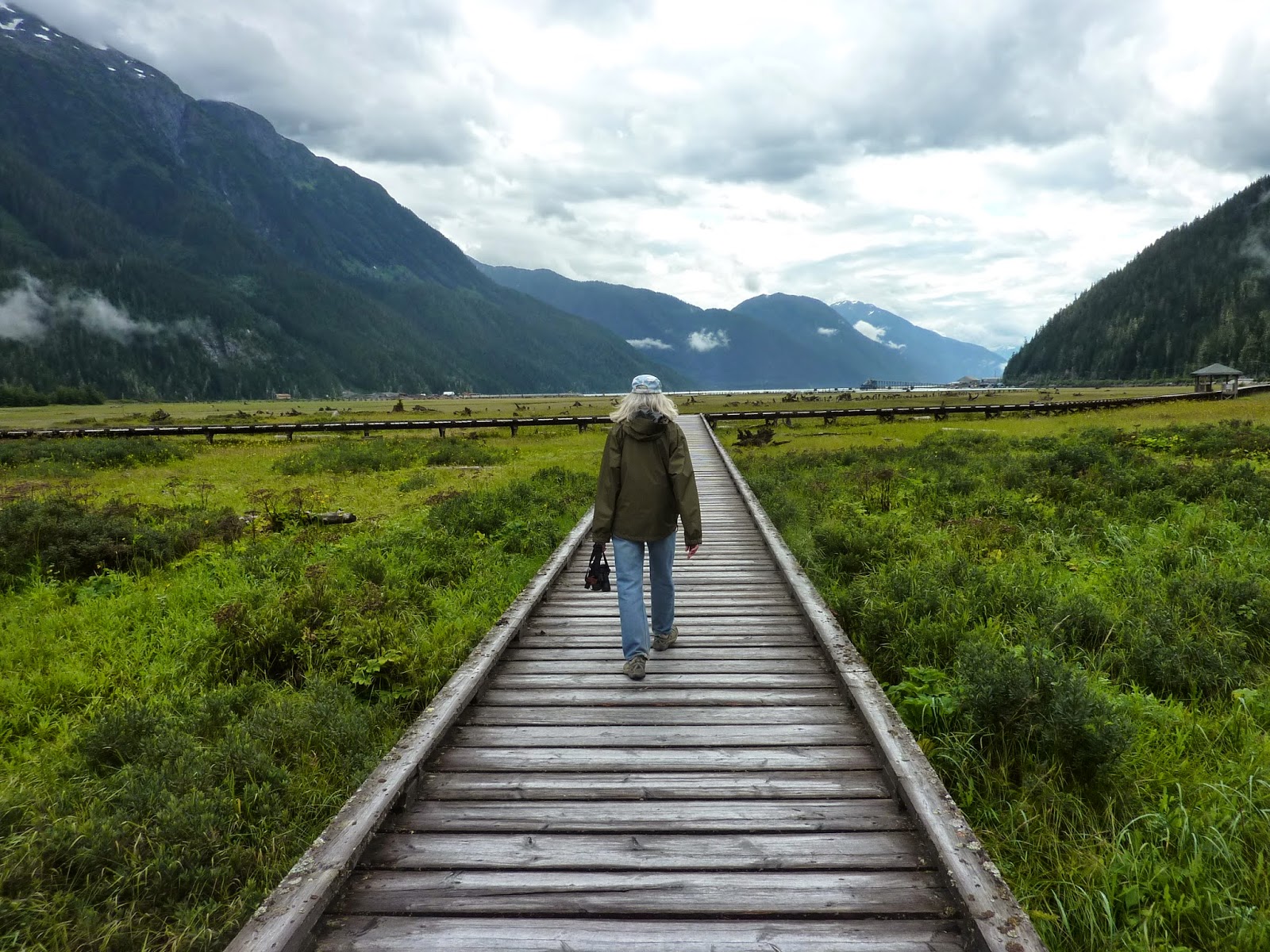
A walk out to the estuary to look at birds. Aren't these coastal mountains amazing?
A poster of photos from the movie "Insomnia".
A poster from the movie "The Thing" with Kurt Russel.
A movie poster from "Iceman". If you haven't seen these movies, they're all good.
We visit the Historical Society Museum in Stewart to see their display of posters of movies made here in this somber landscape. These include “Insomnia” with Robert DeNiro and Robin Williams, “The Thing”, “Ice Man” and “Bear Island”. This gloomy, misty landscape certainly creates the atmosphere for these films.
On the way to Salmon Glacier. Water flows from the toe of the glacier to become the Salmon River.
A view of one of the many glacial valleys along the road to Salmon Glacier. Fireweed is in bloom. The ice field is high above.
At the view point overlooking the Salmon Glacier.
 Next we visit Hyder where the road to Salmon Glacier begins. This is one of our bucket list items for this trip. The drive takes us up a 28-mile gravel road to a mountain slope overlooking Salmon Glacier, the 3rd longest glacier in North America. It’s the only glacier you can drive to and get a view looking down on it.
The glacier flows out of the ice field above . . .
. . . and down the valley below us.
There are many waterfalls along the road to Salmon Glacier.
The glaciers’ mass of ice and moraines flow in serpentine curves from the shrouded ice fields above and down through the valley below us. It’s a living thing on the move and we can see evidence of its slow crawl as our eyes sweep down the valley.

See the water pouring inside the ice cave at the toe of the glacier?
On the way back we stop at the forest service bear viewing area but it’s too early to see bears. Lots of people with big camera lenses are waiting patiently on the boardwalk. We have bear-sized appetites and don't wait for them to make an appearance.

Waiting for bears on the Bear Walk.
We watched Chum and Pink Salmon in their spawning frenzy, always an amazing thing to witness. 

Watching male Salmon battle each other in the spawning frenzy.
Mew Gulls are always in attendance at the spawning waiting for easy meals.
A Great Blue Heron fishes at a pond at the Bear Walk
Going back through Hyder we stop to have a rare dinner out at the Bus Seafood Express, a brightly painted bus that’s a local favorite and serves fresh sea food. A friendly place to chat with other visitors and locals.

Eating out at the Bus Seafood Express.
We leave the coast and go inland in search of sunshine. When the sun comes out we stop for another bike ride on the beautiful Cassiar Highway.

Bicycling on the Cassiar Highway with the coastal Cassiar Mountains in the background.
Our next stop will include a visit to some historic First Nations sites. 

Like the bears, we'er heading on down the road.
See you down the road.

Jackie

Thursday, November 6, 2014

Alaska – Canada Travels 2014, Whitehorse in the Yukon to Boya Lake on the Cassiar Highway in BC, August 12th to 16th.


Driving through Beringia.
It’s time for us to turn our Sprinter south as we head for Whitehorse, a good place to resupply.

Driving through Beringia.
We follow Highway 2 from Dawson City to Whitehorse for over 300 miles through the countryside of low forested mountains and broad river valleys. The country is beautiful; the road's in good condition and traffic is sparse. We're traveling along the eastern edge of a land mass called Beringia,  The Bering Strait land bridge that connected Siberia and Alaska during the last glaciation 10,000 years ago. At that time great quantities of water were tied up in glacial ice and more land mass was exposed due to lower sea levels. The strait and much of Alaska and the Yukon were free of the ice that covered the high mountains in Alaska and much of central Canada. Here roamed nomadic people, mammoths, giant sloths, saber tooth cats and giant short-faced bears, a menagerie of challenging animals to make Beringia an interesting place for the up and coming humans.  

Five-finger Rapids on the Yukon River.
On the way to Whitehorse we stop at Five Fingers Rapids on the Yukon River. 

260 steps to descend to the trail to Five Fingers Rapids.
There is a 260-plus step stairway that leads down to the half-mile trail which we hike for a closer look at the rock islands that separate the Yukon into five channels of turbulent water.

The rock islands that separate the Yukon River into rapid filled channels.
This was a major obstacle to river boats going to Dawson City. The boats had to winch up river through the rapids to get back to Whitehorse.

The Beringia Interpretive Center
We spend a couple nights in Whitehorse to resupply and visit the Beringia Interpretive Center. 

Mammoth skeleton, they really are huge. Wouldn't you have loved to see a herd of these creatures?
Here we see skeletons of ice-age giants like the Mammoth, Short-faced Bear and Giant Sloth.

A Short-faced Bear skeleton. A Grizzly Bear skull sets at its back feet. You would not want to meet one of these guys.
A Giant Sloth. I hope these guys were more cuddly than scary.
The theater in the center shows an excellent 35-minute film about how the creatures and humans of Beringia adapted and survived the ice age 10,000 years ago. Very interesting and well worth the visit. Plus you can take your picture with a mammoth and giant beaver.

Mammoth Love. Say Ahhhh.
Beringia had giant beavers, too.
We pass by Swan Lake on our way to Watson Lake. The Fireweed is still in full bloom.
From Whitehorse we head south on the Alaska Highway to Watson Lake where we turn onto the Cassiar Highway 37, leaving the Yukon and entering British Columbia.

Traveling the Cassiar Highway and no one in sight for many a mile.
The northern segment of the Cassiar Highway is narrow and unmarked but has good pavement and very little traffic. The scenery is outstanding. We spend the night at the French Creek Recreation Site, a little primitive, 5-site campground along the Dease River. Camping is free.

At French Creek we watch a beaver dining on willow.
The next day we leave early for a short  20-mile drive to our next destination, Boya Lake Provincial Park. The park was high recommended to us and it’s a natural beauty.

Our campsite at Boya Lake.
The campground is nicely laid out and well maintained by the friendly staff. There are forest and lakeside sites. The lakeside sites are definitely the best with views of a crystal clear lake colored in ever-changing hues of blues and greens due to limestone in the water.

The view of Boya Lake from our campsite.
Boya Lakes crystal clear water.
The Park had 3 canoes and 2 kayaks for rent. We rented a canoe on our first day.  
We rent a canoe and paddle around the Boya Lake islands.
What looks like a shore line on the opposite side of the lake is really many islands that we could paddle around. We see fish below us in the clear water until the lake becomes too deep and turns a deep blue green. It's a really remarkable day because the air is perfectly still and the lake is a glassy calm.

More passages open up as we paddle through the islands.
We paddle up to our lake-side campsite.
Oh beautiful blue waters!
We pass by a Loon calling as it glides across the lake.
The Boya Lake dock.
We wanted to rent the kayaks the following day but strong winds came up and we decided to bike instead and have at least one ride on the Cassiar. Strong winds always slow a biker down so we struggled into the wind for about 10 miles and when we turned around had a great tail-wind to blow us back to the campground.

The Cassiar Highway is very bike friendly. 
An incoming front forms a wave cloud above the Cassiar Mountains.

Perfect reflections on the face of the lake.
The kayaks weren't available the next day so we decided to go on down on down the road.
Stay at Boya Lake if you ever get the chance. We’ve see many beautiful lakes but Boya is tops.
We startle a Spruce Grouse on a hike in the woods.
We’ll be heading south on the beautiful Cassiar Highway to visit Stewart, Hyder and the Salmon Glacier.

Heading down the Cassiar.
See you down the road.
Jackie

Friday, October 31, 2014

Alaska – Canada Travels 2014, Dredge No. 4 near Dawson City, August 11th.


The No. 4 Dredge.
Before we leave Dawson City we take a tour of Drudge No. 4 National Historic Site, the largest wooden-hulled drudge in North America. It was a floating gold-panning factory and an amazing piece of machinery that mined and separated placer gold in a continuous process. The dredge is immense and it was a feat just getting the parts to this remote location to be assembled.

The basic concept of the dredge.
Information panels explain the operations.
You can only go into the dredge on a guided tour which is interesting and amazing. I can't explain like our guide did precisely what all of these various parts and giant gears do so just enjoy the photos from the interior of the dredge. Big gears and machines are works of ingenuity and, after their fashion, works of art.
Some of the gears that operated the dredge.
 
Our guide explains how the dredging works.


Our guide explains the control room operation where the foreman commanded the operation.
The foreman looked out this window as the dredge was operating and watched the bucket chain scoop the gold bearing gravel into the dredge.
The buckets in the bucket chain that scooped the gravel sit along the path and have become planters for wild flowers.
A single bucket from the bucket chain.
The trammel that separates the gravel from the placer gold. 
The shakers that act as gold pans and separates the gold from the fine gravel at the end of the process.
The conveyer that sends the processed gravel out the back of the dredge and created the gravel piles that fill in the stream bed as the dredge moves forward up the river.
The dredge created sweeping gravel piles that accumulated behind the dredge. These have re-vegetated and are once again home to wildlife.
The back end of the dredge and the conveyer that dumps gravel back into the river bed.
Gold mining operations ended here in the 1950’s.

Next we had south again to Whitehorse in the Yukon.
See you down the road.

Jackie